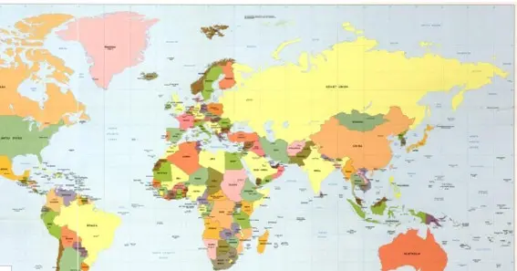
Maps are essential tools for representing the Earth’s surface, each serving unique purposes. Among them, political maps play a crucial role in illustrating human-made boundaries and political divisions. This article delves into what a political map is, its key features, and its various applications.
What Is a Political Map?
A political map is a type of map designed to show governmental boundaries of countries, states, and counties, along with the locations of major cities and significant bodies of water. Unlike physical maps, which emphasize geographical features like mountains and rivers, political maps focus on the imaginary lines that define territorial boundaries.
Key Features of Political Maps
Political maps are characterized by several distinct features:
- Boundaries and Borders: They delineate the borders between countries, states, and other administrative regions, often using lines or color differentiation.
- Capital Cities and Major Towns: These maps highlight administrative centers, providing valuable information about the hierarchy and organization of power within a country.
- Significant Bodies of Water: While the main focus is on land divisions, political maps also include major bodies of water, such as oceans, seas, lakes, and rivers, which often serve as natural boundaries between nations.
Applications and Uses
Political maps serve various purposes across different fields:
- Educational Tools: They are fundamental in teaching geography, offering a visual aid to understand the complex web of international borders and political divisions.
- Planning and Policy Making: Governments and organizations use political maps for planning, policy development, and diplomatic negotiations, ensuring decisions are informed by accurate geographical data.
- Navigation and Travel: While not as detailed in navigational features as road maps, political maps assist travelers in understanding the geopolitical context of their destinations.
Reading and Interpreting Political Maps
To effectively use political maps, it’s essential to understand their components:
- Legends and Symbols: These explain the meaning of various symbols and colors used on the map, aiding in accurate interpretation.
- Scale: Indicates the relationship between distances on the map and actual distances on the ground, helping users gauge the extent of regions.
- Orientation: Typically, political maps are oriented with north at the top, but it’s crucial to check the compass rose for accurate navigation.
Conclusion
Political maps are indispensable tools that provide a clear and organized visual representation of political boundaries and significant geographical features. They play a crucial role in education, navigation, and geopolitical analysis, helping individuals and organizations understand the complex political landscape of the world. Whether used for navigation, research, or gaining an understanding of international relations, political maps are essential tools in the study of geography and politics.
FAQ
- What differentiates a political map from a physical map?
Political maps focus on man-made boundaries and political divisions, while physical maps highlight natural geographical features. - How often do political maps need to be updated?
Political maps must be updated regularly to reflect changes due to political events, such as wars, treaties, and new legislation. - Can political maps show disputed territories?
Yes, but how they are shown can vary depending on the map’s perspective, often leading to controversy. - Why are capital cities often highlighted on political maps?
Capital cities are highlighted to denote political importance and administrative centers within a country. - How has technology impacted the creation of political maps?
Technology, especially GIS and satellite imagery, has made political maps more accurate, detailed, and accessible to a broader audience.


